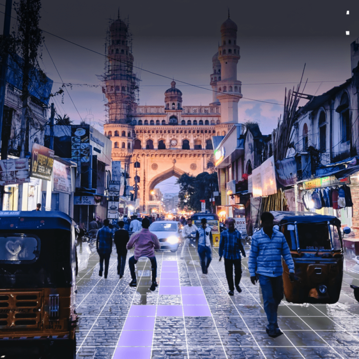
Poor addressing systems are a significant economic burden for emerging economies, and India is no exception. In fact, it is estimated that the cost of bad addresses in India is between $10-14 billion annually, which accounts for roughly 0.5% of the country’s GDP. The consequences of such addresses are inaccurate geolocation, which can hinder emergency services’ ability to reach people quickly and logistics industries’ ability to improve on-time performance and efficient routing of packages.
The economic impact of poor addresses in India is due to various factors, such as local abbreviations, colloquial neighbourhood names, unclear directions, and variations in local languages being transliterated in English for writing. Furthermore, localities and pin-codes have poor localization, and 20-30% of written pin-codes are incorrect. Even when landmarks are included in the address, the average distance between the location of a point-of-interest written in an address and the actual location of the doorstep is around 400m, which doesn’t significantly improve resolution.
There have been numerous systems introduced to address this issue, and while some have proven effective in some ways, they can still be confusing for the end user and have technical drawbacks. Therefore, it is crucial for India to prioritize the implementation of cutting-edge and effective solutions, transcending legacy systems, in order to foster progress and innovation in the industry.
To reflect deeper into the challenges that inaccurate addressing poses on India’s hyperlocal economy and discuss how mapping has evolved over the years, we spoke with Shashank Jaiswal – Country General Manager at UNL in India.
Shashank has over 19 years of experience in the technology industry, specializing in telecom, smartphone, and geospatial domains. Before joining UNL, Shashank was Vice President of Sales at MapMyIndia. He holds numerous accolades for his contributions to the Indian Automotive industry and is also an active board member of the Charge Point Operators Society of India and the Warehousing Association of India.
Location-based services have come a long way from their origins as tools for navigating between two points. Nowadays, they have become essential in almost every sector and have become sector-agnostic. India has been making great strides in the geospatial industry globally. It is projected that the industry’s total size will be around USD 3.5 billion, and it is set to reach USD 5 billion by the end of 2025.
The hyperlocal industry will revolutionize the user buying experience and consumer behavior, as companies will be pushed to innovate and integrate next-generation technology to meet the changing demands of consumers.
Clean transportation plays a crucial role in achieving sustainability and net-zero emissions. The Indian government has adopted various national and state-level policies to promote electric mobility. The Faster Adoption and Manufacturing of (Hybrid and) Electric Vehicles in India (FAME) India Scheme Phase II encourages the implementation of EV charging stations and offers capital subsidies. India’s target is to reach 30 per cent EVs by 2030, and they are implementing purchase reductions, lower road taxes, scrapping and retrofit incentives to achieve this goal. The government also introduced the Production-Linked Incentive (PLI) Scheme to develop local manufacturing capacity and support the EV supply chain. Additionally, many states have implemented their own EV policies, offering financial incentives, infrastructure development, and exemptions from taxes and fees.
Micro-mobility has spurred the growth of the Indian EV ecosystem with upgraded vehicles offering easier charging options. A great example would be how The Ministry of Road Transport and Highways (MoRTH) has allowed 16-18-year-olds to drive e-scooters, which helps promote electric mobility among the younger population.
However, there are still challenges to overcome for mass adoption, such as improving infrastructure, reducing charging times, and enhancing vehicle performance.
The NHEV project that UNL is working on in India aims to create a geofenced eCorridor along the Delhi-Jaipur highway to encourage the adoption of commercial EVs and reduce transportation-related emissions. To address the challenges associated with EV adoption, such as locating charging stations and providing roadside assistance, UNL has developed an innovative solution using a patented pixelized routing algorithm and smart micro-location platform. This platform supports precise mapping of EV infrastructure, location sharing, and routing features for various types of EVs. It also offers immersive 360-degree views of charging stations and their amenities, helping riders and their families plan their journeys more efficiently. Additionally, the platform supports e-commerce companies by enabling last-mile delivery near EV stations. All of this is done with a strong focus on data privacy and autonomy.
India’s addressing system is complex and non-standardized. Administrative boundaries and regular changes in city and road names make it challenging for companies to deliver their parcels as scheduled. These delays result in inconvenience for both the end users and the company’s operations team, making it challenging to devise optimal route planning strategies.
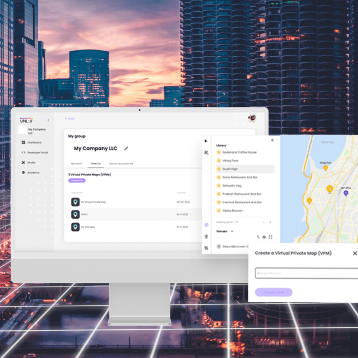
Our UNL geoID provides a unique digital address for every physical location, helping to achieve standardization in mapping and creating a systematic way location-based data is stored, managed, and shared across multiple platforms.
By providing tools for capturing, storing and continuously validating customer geolocation address data and contextual data like nearby landmarks, this system can significantly optimize delivery routes and help businesses deliver faster, more efficient services. Innovative solutions can streamline operations, reduce delivery times, and enhance the end-user experience.
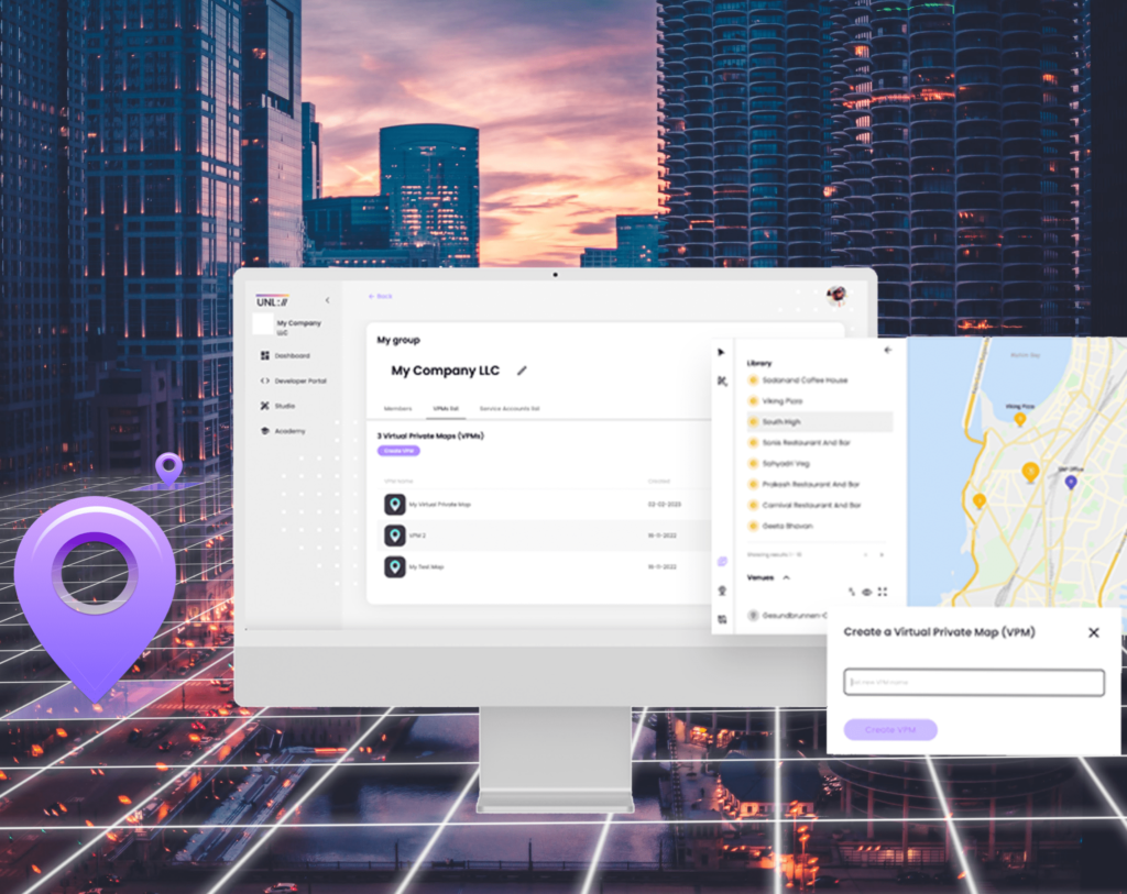
Beyond that, UNL is an advocate for data autonomy and privacy, and in line with this commitment, it has introduced value-added services such as Virtual Private Maps. These services enable businesses to securely bring and store their sensitive geospatial data, conduct in-depth geo-analytical planning, and develop strategies for future monetization of their proprietary geospatial information.
What excites me the most about the Internet of Places is the opportunity to be part of a company that is building innovative next-gen mobility applications. At UNL, we’re creating a comprehensive demarcation of location, which solves complex location-based service challenges in India. By leveraging the Internet of Places, we are addressing the existing gap in India’s location infrastructure, serving as the much-needed missing link. The future of location-based services is going to be transformative, and at UNL, we’re committed to helping our clients stay ahead of the curve.
Our Team can help you with:
Our Team can help you with:
Fill in your details and we’ll get back to you in no time.