UNL Platform is here. Run your entire ecosystem in one place. ![]()
UNL Platform is here. Run your entire ecosystem in one place. Learn more
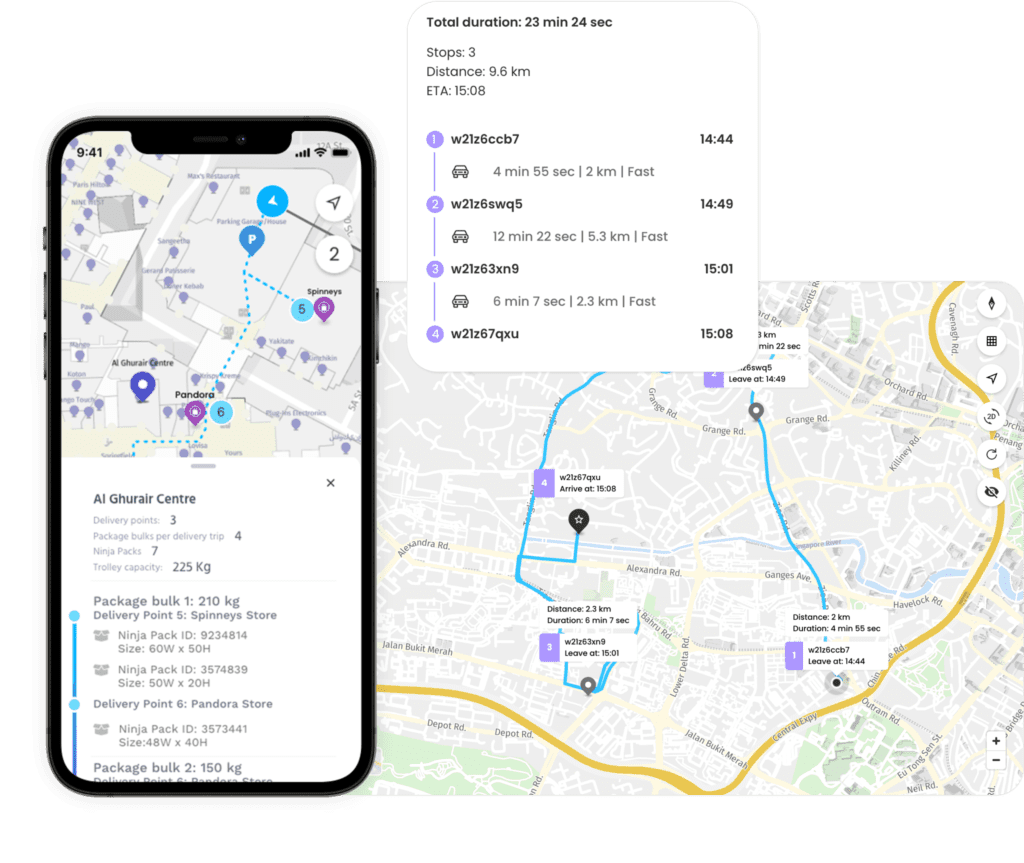
Embed accurate routing, calculate high-efficiency optimal routes and supercharge your navigation requirements.


Compute single or multi-waypoint routes, distances and travel times for various transport modes.
Supports seamless transition between outdoor and indoor spaces
Single, multi-waypoint and time-aware routing and dynamic ETA calculation
Supports multiple transportation modes – two-, three- or four-wheelers and walking
Calculates distance and travel times to destination
Compute travel times and distances between multiple origin-destination pairs.
Supports multiple transport options: car, truck, two-wheeler and pedestrian
Leverage optimized routing summary, including duration and distance calculations
Estimate accurate ETA and travel times


Isoline APIs compute the routable area within a specified time or distance range, taking into account preferred route mode (shortest/fastest).
Takes into account real-time and historical traffic information in its calculations.
Option to avoid road types (highways, toll roads, unpaved roads, motorways, tunnels, etc.)
Supports departure time preferences
Calculate optimum routing sequences by optimizing routes within a given set of waypoints based on time or distance traveled.
Calculate waypoint sequence to get routes with shortest travel time
Calculate waypoint sequence to get routes with minimum travel distance
Optimize average cost per delivery/ride with optimized routes


Support complex routing scenarios and create dynamic route plans using advanced route optimisation services for multiple configurations including vehicle type, fleet capacity, multiple-pick up and drop-off points and delivery requirements.
Designed to solve the travelling sales man problem between multiple locations for a full fleet of vehicles
Optimize fleet utilization and deliver complicated routing solutions while meeting business requirements and SOPs
Match routing data via GPS traces with real-time road network data to calculate the most likely drivable route on the map.
Supports route avoidance
Delivers accurate ETA information with parameter settings for departure or arrival times
Supports Pedestrian, Bicycle, Car, carHOV, Truck, Taxi, Bus & Motorcycle routing

Newsletter
Join the UNL community.
© 2023 UNL GLOBAL. All rights reserved.
Fill in your details and we’ll get back to you in no time.
Our Team can help you with:
Our Team can help you with:
Fill in your details and we’ll get back to you in no time.